NDG–History
and Physical Features
Some early agricultural tenants in the area known as Coteau
Saint-Pierre of the new colony of Ville Marie in the 1660s
who left their mark in NDG had names such as Décarie,
Hurtubise, and Milot. NDG Village was established in 1876
and held onto its rural ambiance – the fertile soil
produced apples sent to England and melons famous in New
York and Boston ; the Elmhurst Dairy begun in the late 1870s
boasted 400 acres of grazing land – even beyond incorporation
in 1906 and annexation into the City of Montreal as quartier
NDG in 1910. There were 5,000 inhabitants in 1914 which
blossomed into 30,000 by 1930.
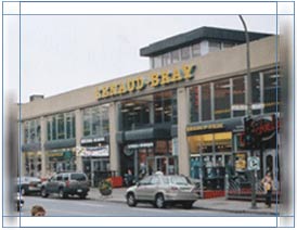
Present-day NDG lies southwest of downtown Montreal.
It is bordered by Montreal West, Côte-St-Luc and
Hampstead in the north, the Ville Émard to the
south and Westmount to the east. Predominant physical
features are the Décarie trench, falaise St-Jacques,
and Concordia western campus. Major arteries are Saint
Jacques, Sherbrooke West, Monkland, Cavendish, Côte-St-Luc
Road, and Décarie Boulevard.
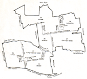
Côte-des-Neiges – History and Physical
Features
The Sulpician and Seigneur de Montréal Dollier
le Casson had the royal geographer set out a new area
northwest of the mountain in 1698, on both sides of a
clear running creek. The creek, which has long since disappeared,
had as its course the present-day Côte-des-Neiges
Road; the east-west configuration of the area streets
(as opposed to the north-south alignment of the rest of
the City) is testament to the creek-access orientation
that was originally established. The fertile soil of the
area allowed for the development of agriculture, and the
bountiful supply of good running water also attracted
tanners; by 1850 there were 50 such operations and the
area was known as the Village des tanneurs. The CDN area
developed as a rural retreat (foxes were hunted at the
Montreal Hunt Club as late as 1925 there!) and was annexed
to the City in 1908-1910.
CDN is bordered on the north by TMR and Outremont, the
west by Hampstead and NDG, south by Westmount and east
by Ville-Marie. Predominant physical features are the
Notre-Dame-des-Neiges cemetery on the western slope of
Mount Royal, Saint Joseph’s Oratory, and the University
of Montreal tower. Major arteries are Queen Mary, Côte-des-Neiges,
Victoria, and Jean Talon.
The CDN/NDG Borough
The borough as a whole boasts a population of 163,110
persons (2001 census), an increase of almost 7% over the
last ten years. CDN/NDG accounts for 9% of the total population
of the City and is the most populous borough. Seventeen
per cent of the inhabitants are 14 years old or younger
and 34.7% fall into the 20 – 39 age group. Persons
65 or older make up 14.5% of the population.
Persons born outside Canada account for 45% of the population
of the borough ; 37% of the total population describe
themselves as visible minorities; for 42% of borough residents,
the mother tongue is other than French or English; 28%
have French as a mother tongue as opposed to 30% English.
Overall, 71% of borough residents judge themselves to
be competent in French.
The major sectors of economic activity in the borough
(1998) are retail stores (10%), services (6%), health
(25%) and education (19%). 77,030 persons are designated
"active" (employed or employable). There are
9827 persons (2002) receiving social assistance benefits.
Community activism in the borough is spearheaded by the
Côte-des-Neiges/Snowdon Community Council and the
NDG Community Council. The borough contains 2 CLSCs (CDN
and NDG/Montreal-Ouest), 2 universities (UdeM, Concordia),
and 6 hospitals (Jewish General, St Mary’s, Ste-Justine,
Julius Richardson, Catherine Booth, and the Institut universitaire
de gériatrie).